SkyShield Technology

Deploy aerial intelligence in three minutes.

A backpack-portable VTOL aircraft, the ground station that flies it, and AI analytics that read the feed while it is still in the air. Built as one system, by one company.
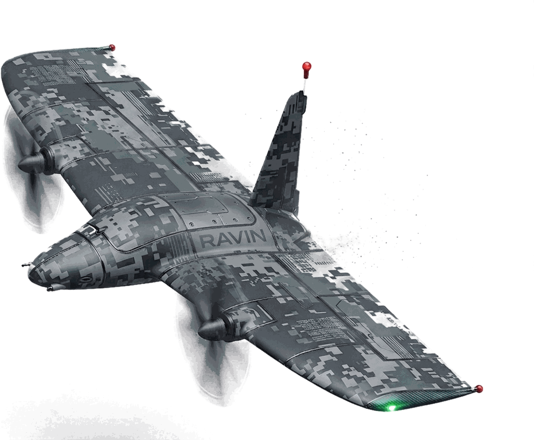
The Ravin VTOL tailsitter in flight in a digital camouflage scheme, both wing propellers turning and wingtip navigation lights lit.

In flight

Ravin, airborne.

Flight footage Ravin in the air — coming shortly

Vertical launch, transition and wing-borne cruise.

AI alerts

It watches the whole feed.

An hour into a flight, attention drifts — the feed doesn't stop. The AI reads every frame and raises the alert itself, so a person on a rooftop or a car in the water isn't waiting on someone happening to look.
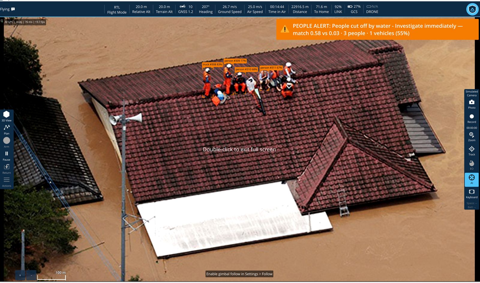
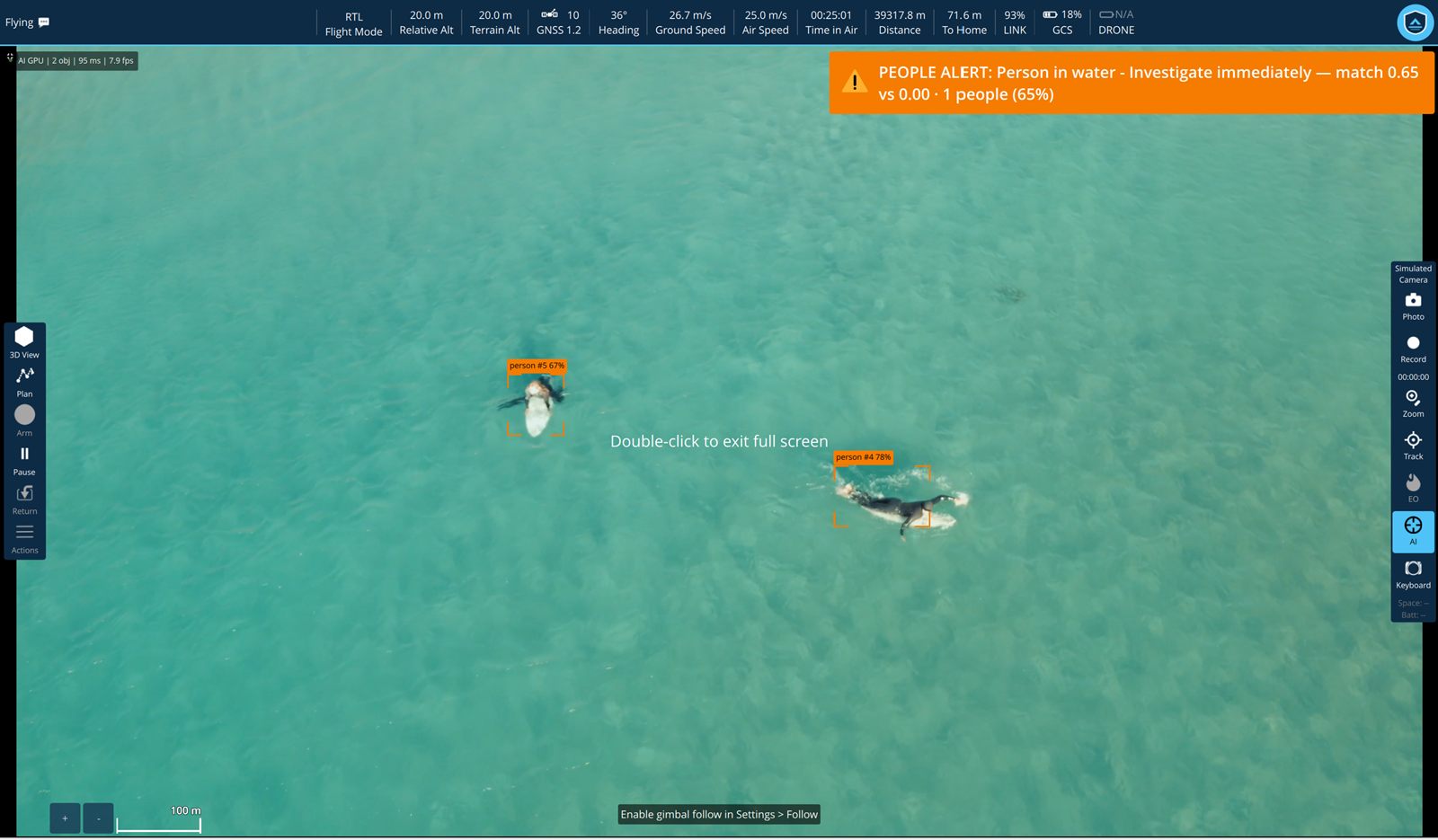
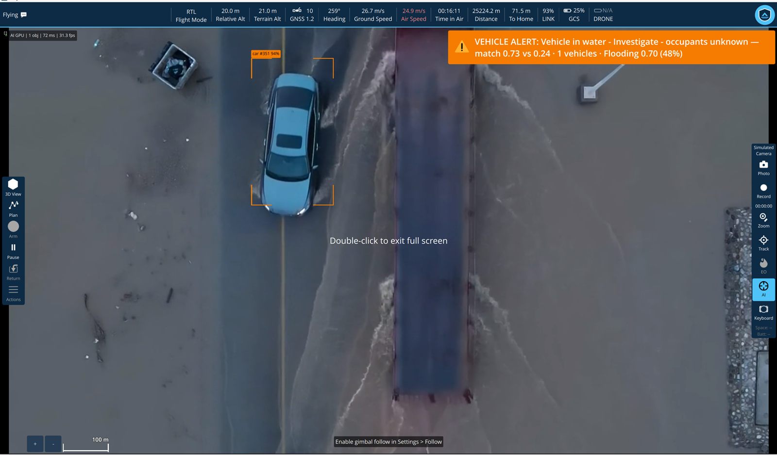
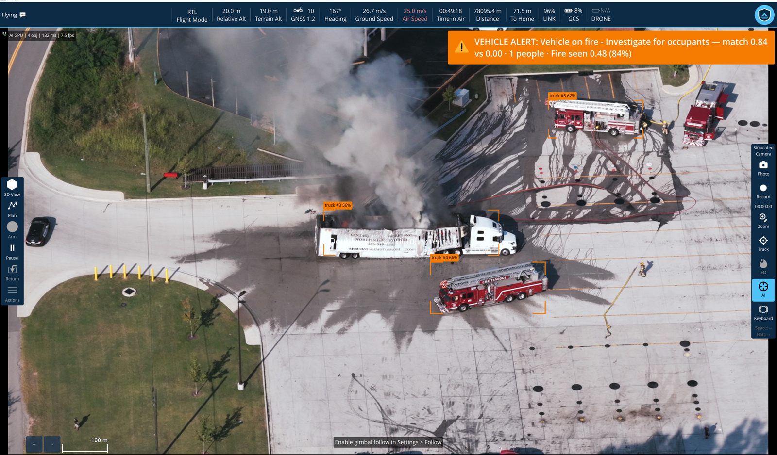
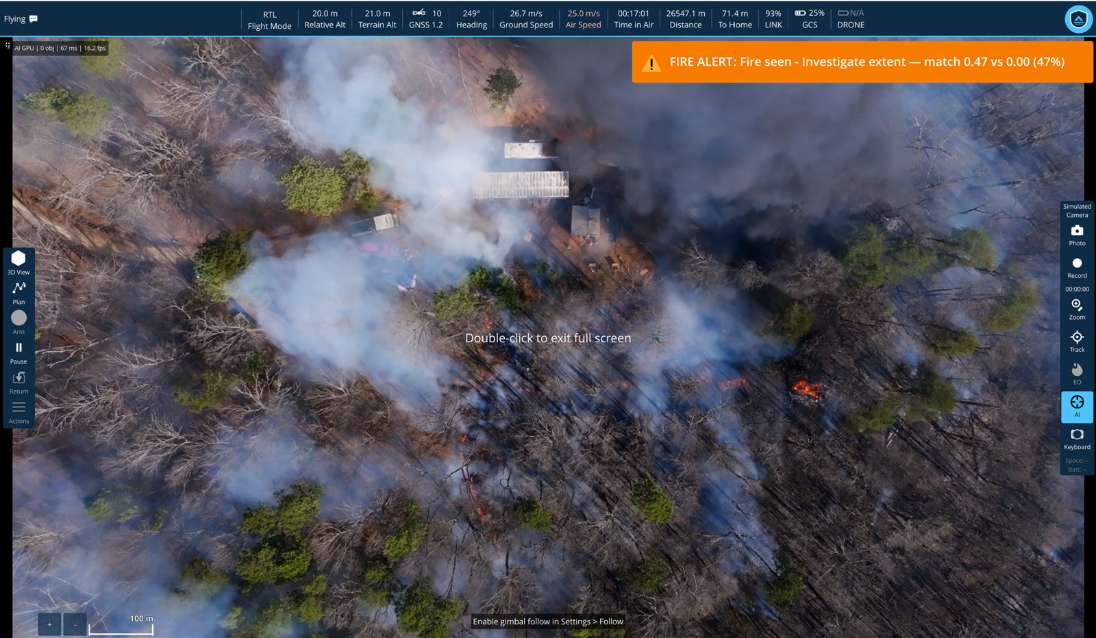
The ground station over a flooded town, the water risen to the eaves. Four people in orange rescue gear are gathered on a tiled rooftop, each boxed and labelled — person #309 at 77 percent, person #310 at 68 percent, person #311 at 67 percent — with a truck picked out at 83 percent. An amber banner reads 'PEOPLE ALERT: People cut off by water - Investigate immediately — match 0.58 vs 0.03 · 3 people · 1 vehicles (55%)'. A wide stretch of open turquoise water seen from altitude, empty but for two swimmers far apart. Both are boxed and labelled, person #5 at 67 percent and person #4 at 78 percent. An amber banner reads 'PEOPLE ALERT: Person in water - Investigate immediately — match 0.65 vs 0.00 · 1 people (65%)'. A top-down view of a pale blue car stranded in brown floodwater beside a submerged roadway, wake streaming past it. The car is boxed and labelled car #351 at 94 percent. An amber banner reads 'VEHICLE ALERT: Vehicle in water - Investigate - occupants unknown — match 0.73 vs 0.24 · 1 vehicles · Flooding 0.70 (48%)'. An overhead view of a car park where an articulated tanker is alight, black smoke streaming across the tarmac. Two fire engines already on scene are boxed and labelled at 62 and 66 percent, the burning trailer at 56 percent. An amber banner reads 'VEHICLE ALERT: Vehicle on fire - Investigate for occupants — match 0.84 vs 0.00 · 1 people · Fire seen 0.48 (84%)'. Woodland seen from directly above, pale smoke drifting in sheets across burnt ground with small fronts of open flame showing orange between the trees and a cluster of outbuildings near the centre. An amber banner reads 'FIRE ALERT: Fire seen - Investigate extent — match 0.47 vs 0.00 (47%)'.
People alert People cut off by water — investigate immediately 3 people · 1 vehicle · match 0.58 vs 0.03 · 55%
People alert Person in water — investigate immediately 1 person · match 0.65 vs 0.00 · 65%
Vehicle alert Vehicle in water — occupants unknown 1 vehicle · flooding 0.70 · match 0.73 vs 0.24 · 48%
Vehicle alert Vehicle on fire — investigate for occupants 1 person · fire seen 0.48 · match 0.84 vs 0.00 · 84%
Fire alert Fire seen — investigate extent match 0.47 vs 0.00 · 47%
GCS · 3D View

Understand the mission before you fly it.

The route drawn over real elevation instead of a flat map. A leg that clips a ridge is obvious at a glance rather than being a number in a column, and a crew can be briefed from the plan the way the aircraft will actually fly it.

3D View — recorded in the station, the plan reviewed against real terrain.

The system

One system, not three products.

The aircraft, the ground station and the analytics are all ours — designed against one another rather than integrated after the fact. One company answers for the whole thing, instead of three pointing at each other.

Ground

SkyShield GCS

Mission planning, live flight, 3D terrain review and payload control in one desktop application.

Intelligence

AI analytics

GPU detection on the live feed — people and vehicles found, tracked and read for what's actually happening, as it happens.

Air

Ravin VTOL UAV

Launches vertically from any clear ground, cruises as a wing, lands back on its tail. No runway, no launcher, no net.

About us

A small team in Dehradun, building for what's next.

SkyShield Technology is a startup based in Dehradun, India — the same mountain terrain in the screenshots throughout this site, not a studio render or a stock demo. What you've seen on this site is what actually runs, flown and tested on ground we know.

We build the aircraft, the ground station and the analytics ourselves, as one system, because that's what we think autonomous aerial intelligence actually needs to become useful — not three products stitched together after the fact, but one team answering for the whole thing, built for where the field is heading rather than just what's easiest to ship today.

Contact

Get in touch.